02 August 2016

Blue Ridge Drive

I didn't spend a lot of time taking pictures on my recent road trip down the length of Skyline Drive, VA (109 miles) and the Blue Ridge Parkway (469 miles) in to NC. Here's a few highlighting the gentle beauty of the region in summer. Elevations anywhere from 3000' to 6500'. (For the record, it was 10-15º cooler than the rest of the low-lying South)

Sunset over Shenandoah from restaurant window
Cabin in the woods
Hiking through an evocative, primeval-feeling mist
Waterfall and Fallen Log
Tiered waterfall
Rustic roadside attraction
Dappled sunlight & shadow falling across rocky creek & rhododendron
Linville Falls, NC
Table Rock over looking Linville Gorge some 2000' below
If you ever have any questions why it's called the "Blue Ridge"
Mountains nearly reaching the belly of the sky

29 July 2016

This Week in Water

I apologize for the break in #ThisWeekInWater posting. I've dived in the Pacific and swam miles in the Atlantic, splashed through Appalachian mountain creeks and run through Georgia torrents in the interim—all the while trying to keep hydrated in the heat. Also, we married off a son at a beach wedding who is, even as I write this, on a honeymoon boat to the Faroe Islands and Iceland. Meanwhile, the world's water issues have not resolved themselves. So for the next few posts we'll be playing a bit of catch-up (if that's even possible).

Climate change—that is to say, global heating—is causing oxygen loss in vast areas of the Pacific, and some fear all life in the ocean may suffocate in the coming decades. This is a real thing.

"A key paper about the threats of climate change to World Heritage sites intentionally left off any mention of the Great Barrier Reef after the Australian government raised an objection..." to UNESCO

Sea level rise has already swallowed five islands in the Pacific's Solomon Islands. Scientists link the destructive rise to human-caused global warming.

Melting permafrost is further exacerbating global heating.

Unsustainable fishing is threatening to cause the extinction of some of the Philippines' largest fish.

Nearly a million gallons of molasses from a sugarcane processing plant spilled into a river in El Salvador, threatening wildlife and humans downstream as well.

Water levels in Lake Mead reached record lows, and despite a relatively wet winter, drought conditions in much of Southern California remain unimproved.

Malaysia's dams and reservoirs have been drying up causing severe shortages.

The World Bank reports that water scarcity, exacerbated by climate change, could cost some regions of the world upwards of 6% of their GDP by 2050, spurring migration and sparking conflict: "High and Dry: Climate Change, Water and the Economy."


That should be enough to keep you busy (if not paralyzed with depression) for now.

30 June 2016

Pacific Paradise, Pt. 6

This will be my last post of photos from Moloka'i. Most of these are from the trek up to Kamakou Preserve, a magnificent tropical rain forested area in the highlands of the island. There's an 8-mile drive up a rough dirt road through cattle farms, then a further 8-mile drive on what is tantamount to a rugged off-road track. From there, you hike several miles through a bog on top of the mountains, maintaining your footing the best you can on a series of 1" x 8" planks. If (and when) you step or slip off the boardwalk, if you don't twist them you sink above your ankles in sucking mud and can easily lose a shoe. For what it's worth, the effort to maintain balance on an 8" board for several miles of climbing requires serious core stability. The area starts at a picnic area about 3000' above sea level and climbs up to more than 5000' elevation and is replete with native foliage preserved by the Nature Conservancy. Enjoy! (as ever, click pics to embiggen slideshow!)

You can also see the island way down there in the 6th pic in Pt. 4 from Kalaupapa Peninsula. Elevation ~3000'.
View of Moloka'i from the road. Elevation ~4000'
Boardwalk & Indigenous Rain Forest. BTW: No snakes or spiders, and few mosquitoes!
Lookout point in the clouds at ~5000' elevation.
Clouds clearing momentarily—Ohi'a plant in the foreground guarding dramatic sheer cliff drop off.
Indigenous Rain Forest Plants
Cliff, Clouds forming, & Circular Rainbow. 3000'
Double Waterfall. Elevation ~3000'
Ancient-style Fish Pond en route to Halawa Bay
Sea cliffs rising into the clouds above Kalaupapa Peninsula (note island in the distance from first pic above) 
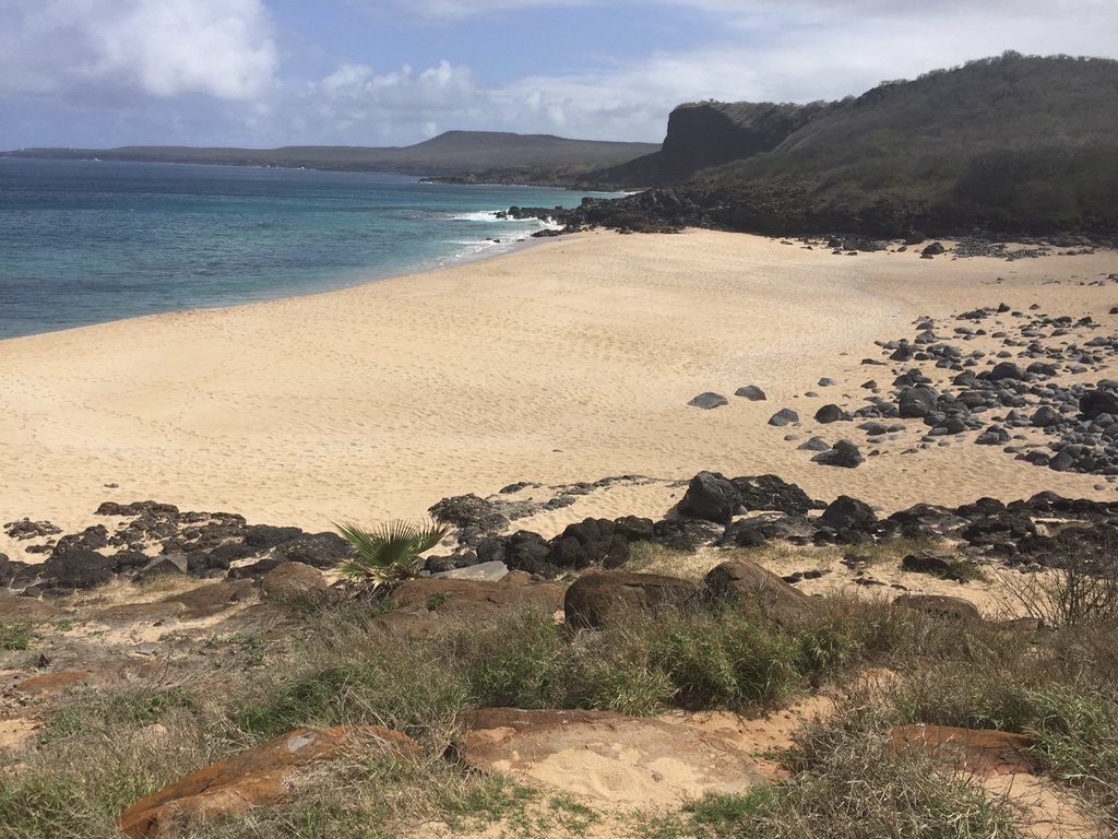
Perfect, deserted beach cove back on West End where we stayed
And, yes, sunset from our lanai at dinner time

25 June 2016

Pacific Paradise, Pt. 5

Molokai, Hawai'i, has its equivalent to Maui's famous Hana highway—much shorter of course. We drove to the end of the road at Halawa Bay Beach Park. Due to time constraints we did not get to take the hike inland to the waterfalls. There are a couple other pics from the drive to Halawa in my first and second Molokai posts below—e.g., the jetty & me on the rocks. (Click pics to embiggen slideshow)
Beach cove en route with mountains & clouds as backdrop. Sweet swimming spot with Maui across the strait. 
Hawai'ian house overlooking the ocean
Nene is the state bird, endemic Hawai'ian goose
Gaggle of Nene
Nene
Dramatic view of Halawa Bay from the cliff top
Halawa Bay with waterfall visible

20 June 2016

Pacific Paradise, Pt. 4

Kalaupapa Peninsula is, as the name suggests, a peninsula approximately 2.5 miles by 2.5 miles on the north coast of the island of Molokai, Hawai'i. It juts out from what are purportedly the highest sea cliffs in the world. It was formed when one such cliff sheared off and a volcanic peak arose from the bottom of the ocean millions of years ago. There are only three ways to get there: fly, ride a mule, or hike down the steep three-mile trail. Either way, you need specific permission. (I'm informed that a barge arrives every July as well, bringing supplies to the residents). Once there, there is a four-hour guided tour.

We chose to hike down the 1760' cliff face. Each of the 26 switch backs, thankfully, is numbered. Going down is murder on the knees—because you are, essentially, braking with each step. Going up takes a toll on your thighs and cardio-vascular system. We figured the hike was the equivalent of climbing down then back up a stairway to the top of a 200-story skyscraper—in the tropical heat and humidity.

Kalaupapa was formerly a leper colony. Folks with the disease were shipped here from all over the world and left to fend for themselves. It was brutal until a kindly priest and a dedicated nun brought consolation and community, treating those afflicted like human beings. Of course, leprosy—now known as Hansen's Disease—has been curable for many years. Now, the peninsula is a National Historical Park. And, quite possibly one of the most beautiful spots on earth. Below are some pictures from our hike (click pics to embiggen slideshow!):

Rainbow peeking out from behind sea cliff down which we are hiking
A rocky beach beside the trail at the bottom of the hike down Kalaupapa
The view from the pier in Kalaupapa 
2000' Sea Cliffs
Famous church built by Father Damien
Sea Cliffs (as you face east from Kalaupapa) reaching to the clouds
Sea cliffs, lava rock beach
Sea Cliffs (as you face west from Kalaupapa) + Black Sand Beach beside the trail back up the cliff
Wild goats on the hike up the cliffs
That is the blue of the ocean (not the sky) from the trail! 
Partial view of Kalaupapa Peninsula (2.5 x 2.5 miles) from the trail head
Kalaupapa Peninsula from the air

15 June 2016

Pacific Paradise, Pt. 3

More from Molokai. (as ever, click pics to embiggen slide show)

We stayed in a small condo complex out on the West End, facing Oahu (you can see how small it is from the plane shot in my first Moloka'i post). There were four, one of them abandoned. The beaches were empty and damn near perfect. I hiked north along the shore  from our place past pristine, abandoned beaches and across what appeared to be an abandoned golf course gradually being reclaimed by the island. At one time, it must have been a beautiful place to play (if you like that sort of thing), and I understand the PGA used to hold events there. But the developers and managers faltered in the first decade of this century, and now its only denizens are wild turkeys, Axis deer (aka barking deer or chital, a gift in the 1860s to the King of Hawai'i for his hunting pleasure), and mongoose—all also invasive species. I kept asking myself as I walked: Is this the future of our country if a certain developer gets his and his friends' hands on our pristine public lands?) As blogfriend BDR likes to say: "metaphors abound."

Deserted West-end Molokai Beach
A perfect, deserted cove beach on Molokai's west end
Old cart path on the former golf course fairway by perfect deserted beaces
Golf ball landing zone no more!
Former golf course green by the sea
Club house ruins
Resort hotel ruins

07 June 2016

Pacific Paradise, Pt. 2

More pics from Moloka'i. [Click pics to embiggen slideshow]

"What the...? A surprise party! I'll kill you. Whose idea was this? All right, everybody's coming to my place. This is ridiculous. Senator, hang onto that, will you, for me?"
Lava boulderette beach Halawa Bay Beach Park
Wisdomie & Wesdom on the 1 x 8 boardwalk on the hike through Kamakou Preserve bog, a tropical rainforest filled with endemic plants leading up to 5000' overlooks 
After off-roading like a boss up to Kamakou 
Hiking down to Kalaupapa Peninsula & former leper colony (apologies to Hudson River School)
On the trail by the shore on the way to Kalaupapa (my knees were red from the steep downhill)
Mules (for those who didn't hike down to Kalaupapa)
'Ohi'a Lehua — Metrosideros polymorpha, endemic to Hawai'i
Heliconia platystachys