If you learn only one word from me and my crappy travel blog post, it should be 'Banff'. Banff National Park in the Alberta, Canada Rockies.
And the summertime highlight of that park is Lake Louise. (There is, apparently, great skiing there in the wintertime also.)
Lake Louise is pricey, especially the Fairmont Chateau which commands the spot. We camped some 55 kilometers away on the outskirts of Banff town for like $40/night Canadian, drove in early, arriving before 8:00. Even so, we got one of the last parking spots. Otherwise, we would have had to park about 10 km away and ride a shuttle. Instead of fixing breakfast in our camper as we did every other morning, we splurged and ate at the Chateau's breakfast buffet. Fresh caught smoked local smoked salmon, waffles, bacon, coffee, and pretty much anything you might ever want for breakfast fueled our long day's hike. Totally worth it.
Walking out of the Chateau's restaurant toward the lake, I gasped. It was one of those rare moments in my life when I had to stop walking and catch my breath at the beauty and splendor of the setting. Took my breath away—I know, a cliche, but dammit, it happened. High, distant glaciers were emerging from the low mists rising out of the turquoise colored lake. I'd never seen anything quite like it in my life. The first picture below is that moment. Taken with iPhone X camera, it cannot possibly capture the moment but does serve as a reminder.
For the previous couple of days, the sky was brown and cloudy from the forest fires. Once we crossed into the Banff high country, a large bowl surrounded by high, glaciated peaks, the skies cleared. This was, except for Victoria, the clearest, most perfect day of the trip.
I hiked about ten miles, about 2000' of elevation. The fam took an extra loop and hiked a bit longer and higher. Once again, I found myself hiking alone, at the sort of pace I prefer so don't have to watch each foot placement and can take in everything around me and even take a few snapshots. Occasionally, I would hear the boom and crash of a distant avalanche.
At the top of one hike sits the Teahouse on the Plain of Six Glaciers. They serve hot tea and soups. Supplies are hiked in daily by staff. Every week or so, propane and other supplies are helicoptered in. There's a sign on the porch requesting hikers to carry out garbage bags.
If you ever get the chance...
(Click pics to embiggen)
 |
| A moment of awe. |
 |
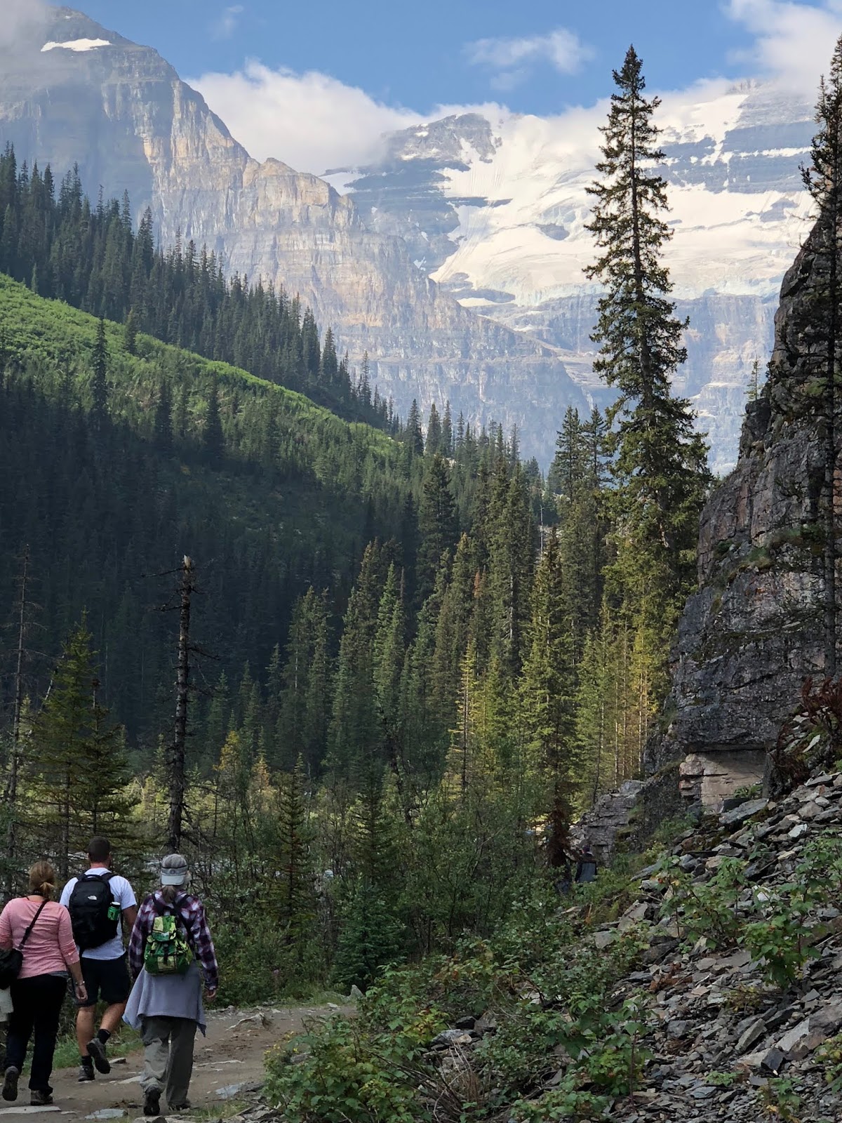
| Let's go hiking. |
 |
| Lake Louise from the trail. |
 |
| Just can't get enough. |
 |
| Heading higher. We reached a level with the bottom of the glacier you can see there. |
 |
| The iconic hiking picture from Lake Louise, Banff, and the Canadian Rockies. (At least to my mind) |
 |
| Currently the wallpaper on my computer. |
 |
| If you enlarge the picture, you can see the narrow, rocky trail cut into the side of the hill. |
 |
| Ever looked under the lip of a glacier? (For scale, it's about 10-12 ft high) |
 |
| Gaining some elevation. |
 |
| The Chateau across the lake on the return trip. |
 |
| The color of the water! (Canoe in the lake for scale) |
 |
| Cooling off our tired feet after a long day of hiking. |
 |
| Last longing look at lingering sunlight hitting the eastern peak above Lake Louise. |
 |
| One of many wildlife crossing structures over the TransCanada pioneered by Banff NP. Used by moose, elk, deer, bear, and many smaller animals. |
 |
| Banff town sign, so as not to forget. |